Category Archives: Software
According to a recent market research study conducted by Market Reports Hub, the 3D Scanner market size is expected to grow, in terms of value, from $3.41 Billion in 2015 to $5.90 Billion by 2022 at a compound annual growth rate (CAGR) of 9.6% between the same time period.
View complete report on 3D Scanner Market here: http://www.marketreportshub.com/3d-scanner-industry-research-marketsandmarkets.html
View complete report on 3D Scanner Market here: http://www.marketreportshub.com/3d-scanner-industry-research-marketsandmarkets.html
The largest gain in popularity can be attributed to portable CMM-based 3D scanners because of the convenience and wealth of possibilities they afford for scanning tight spaces with a high rate of accuracy when applied to conventional and non-conventional scan jobs. Portable CMM-based scanners are categorized into handheld and articulated arm CMM. Expected to grow at the highest rate in the portable CMM category are the handheld 3D scanners.
What is 3D Laser Scanning?
3D Laser Scanning is the process of collecting data points of physical objects using a line of laser light and transforming them into point clouds of data from the surface of said object. The scanner emits the laser light over its full field of view. When the laser light touches an object it then reflects back the light towards the scanner, sending the scanner x-y-z coordinates and information about every surrounding point allowing for a three-dimensional cloud of points to be gathered.
This point cloud information can be saved and rendered in various design softwares, allowing for the creation of 2D CAD renderings, and the x-y-z coordinates allow for the creation of a 3D model. 3D scanners can improve the time of production operations, while reducing costs and redundancy of projects, allowing for less time needed for project timelines and meeting deadlines which results in a more efficient and cost-effective project for every stakeholder involved.
Why Use 3D Laser Scanning?
There are a number of practical real-world applications for 3D Laser Scanning as it pertains to the AEC industry. 3D Laser Scanning services allow for improved Building Information Modeling (BIM) solutions, such as procuring As-Built information for better communication, eliminating the need for manual field measurements, and shortening of project lifecycles.
The cost of scanning services has decreased to now be competitive with manual measurement methods, thanks largely to the advancements in hardware and software solutions. Cost along with the increasing number of analytical options available thru 3D Laser Scanning is making it an increasingly attractive option to conduct detailed surveying of building structures.

Interested in 3D Laser Scanning Services? Click here to learn more about the 3D Laser Scanning services we offer.
Category Archives: Software
In this Tutorial Tuesday, we highlight the newest additions and updates to the 2017 version of AutoCAD® Architecture. This presentation is presented by our Lead AEC Applications Engineer, Dzan Ta.
First, Dzan walks you through the new features and enhancements of the software with an in-depth presentation highlighting the most important features and how they will affect you – the end-user. Dzan then takes you on a step-by-by tutorial of how these new features look in the software, providing you with real world application of what to expect and how to apply it to your design projects.
Click the video below to view:
Did you enjoy the presentation and software walkthrough? Want to download a PDF copy of the presentation for later use? Click here to download: What’s New in AutoCAD® Architecture 2017: Presentation
Related: Tutorial Tuesday: What’s New in AutoCAD 2017
Trade-In and Save

Training Program Options
Repro Products is an Autodesk Authorized Training Center (ATC). We offer a number of courses for every design discipline for the AEC industry. Please see below to select a training course that best matches your needs.
Subscribe and Learn
We also frequently offer free tutorials and how-to videos on our YouTube Channel. Click here to subscribe to the Repro Products’ YouTube Channel.
Category Archives: Software
It’s August, which means that summer is coming to an end. We all wish we had more days to enjoy the dog days of summer soaking up sun, laying out by the pool and drinking Arnold Palmers. But school’s almost in session and its time to register for your classes.
Autodesk Revit Architecture Classes Added for August
We have just added new Revit Architecture classes for the month of August. This should satisfy your thirst for knowledge as you head back into the offices for the 4th quarter push.
For those with a strong handle on Revit Architecture software, but looking to improve their understanding, Click below for information.

Objective: This course is designed to allow students to continue utilizing Revit Architecture to increase their knowledge and productivity through additional collaborative tools, advanced development tools, and advanced construction documents tools.
For those of you looking for a more advanced course? Look no further than:

Objective: Broaden your knowledge of Revit in the areas of Conceptual Design and BIM Management by exploring exercises in mass studies, space planning, visualization, rendering and creating custom families.

Training Program Options
Repro Products is an Autodesk Authorized Training Center (ATC). We offer a number of courses for every design discipline for the AEC industry. Please see below to select a training course that best matches your needs.
Training Courses Offered
- General Design/Platform Technology – Course Descriptions and Schedule
- Manufacturing – Course Descriptions and Schedule
- Infrastructure – GIS and Civil – Course Descriptions and Schedule
- Building/Architectural – Course Descriptions and Schedule
Custom/Project-Specific Training
We also offer personalized training courses held at our training center or your local office per request by calling (770) 434-3050 or Email Us.
We also frequently offer free tutorials and how-to videos on our YouTube Channel. Click here to subscribe to the Repro Products’ YouTube Channel.
Category Archives: Software
Are you still using Autodesk® Land Desktop? If you haven’t heard, the last version of the software – Land Desktop 2009 and Land Desktop Companion were phased out in Spring of 2009 and replaced with AutoCAD® Civil 3D®.
Hey, we aren’t here to judge, but we would like to offer some advice. If having the outdated industry standard for civil design solutions is not reason enough to make the switch to AutoCAD® Civil 3D®, you’re in luck. Our very own Civil Infrastructure Applications Engineer, Dave Young provides 10 reasons why you should make the switch. Watch the video below and and
Now that you have been equipped with ten of the best reasons (in no particular order) to make the switch over to Civil 3D, you are one step closer to optimizing your BIM workflows.
Learn more about Autodesk BIM solutions for infrastructure from the experts at Repro Products, Inc.
Related: What’s New in AutoCAD Civil 3D 2017
Events & Training
Training
If you are interested in earning continuing education credits, we have Training Opportunities available for Infrastructure Design and other disciplines, including Manufacturing, Building/Architecture, and General Design. Training classes can be taken at our corporate headquarters or at your local office.
For more information on the training courses we offer along with a schedule or to schedule your next training class, visit our Autodesk Training Center.
Classes
Don’t forget to sign up to catch Dave Young teaching in Las Vegas at Autodesk University this year when registration opens up on August 17th. This year, he will be teaching Georeferenced Point Clouds into Civil 3D Surfaces and assisting on A360 Infraworks Bridge Design with Revit and Structural Detailing along with our Lead AEC Applications Engineer, Dzan Ta.
Make sure you plan accordingly to take advantage of the Early Bird Registration until October 10th.
Related: AU2016 is Approaching: Meet Our Speakers
Get Social
Make sure to follow us on our social channels and keep up with the latest news in Civil Infrastructure design and Autodesk® products and suites.
Category Archives: Software
Autodesk’s premier annual event – Autodesk University – is four months away, and Repro Products is excited to announce that we have two speakers representing us this year at the world’s largest gathering of Autodesk software users. Our two speakers, Lead AEC Application Engineer, Dzan Ta and Application Engineer, Dave Young will be hosting two classes during the three-day conference in Las Vegas, from November 15-17, 2016.
This year’s theme is “Insight. Innovation. Inspiration” as thousands of CAD professionals converge on Las Vegas to share ideas, tips and tricks with their peers to help improve design processes, foster innovative solutions, and inspire the future of making things.
This year’s theme is “Insight. Innovation. Inspiration” as thousands of CAD professionals converge on Las Vegas to share ideas, tips and tricks with their peers to help improve design processes, foster innovative solutions, and inspire the future of making things.
Sessions
There will be over 650 sessions to attend at this year’s conference with a slew of great information and tips for the 2017 software releases, so make sure you plan accordingly to maximize your time and learning potential as registration will open in August.
Interested in registering for a class led by one of our Autodesk Certified Trainers at #AU2016? See below for session information and registration details.
Tuesday, November 15, 8:00 AM – 9:00 AM
+ A360 Infraworks Bridge Design with Revit and Structural Detailing
Wednesday, November 16, 4:45 PM – 5:45 PM
+ Georeferenced Point Clouds into Civil 3D Surfaces

Related: What’s New in Revit 2017
Plan Accordingly
As stated before, Autodesk University sessions will not be open for registration until August 17th, but in the meantime you have plenty of time to plan out your schedule with the new AU schedule.
Early bird registration is only $1,750 available until October 9th, after that the price jumps up to $2,175 which gives you plenty of time to convince your boss to help you pick up the tab.
Attend Events Before AU
Interested in attending one of our company events led by our Autodesk Certified Trainers? We hold a number of webinars and seminars for CAD users and AEC professionals to help empower your data management and design processes: Click here for a list of events.
Want hands-on training at the Repro Products’ Authorized Training Center? We offer an extensive list of training courses on-site and are conveniently scheduled for you to maximize your time and gain the greatest return on your investment.
Related: What’s New in AutoCAD Civil 3D 2017
Talk to Us
Are you just as excited as us for #AU2016? Leave a comment and let us know what you are most excited about learning during #AU2016.
Category Archives: Software
Welcome to Tutorial Tuesday! This week we are presenting Autodesk Vault: Document Management for Everyone hosted by our Manufacturing Solutions Engineer, Dan Williams in conjunction with DLT Solutions.

In this tutorial, Dan discusses Autodesk® Vault 2016 and all of the benefits it brings to allow you to effectively manage your data. View the 30-minute presentation and step-by-step walk-through to help empower your data management strategy.
Check out the video below:
Related: Tutorial Tuesday: What’s New in AutoCAD Civil 3D 2017
Attend a Webinar
Interested in learning how the newest features of Autodesk® Vault 2017 can further improve your data management strategies? Register to one of our following webinars below to see how Autodesk® Vault 2017 applies to your industry:
Civil:
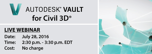
Manufacturing:

Subscribe
Enjoyed the tutorial? Never miss another by subscribing to the Repro Products’ YouTube Channel. We have a wealth of how-to, tutorial, and informative videos to help you complete your project on time.
Click the Subscribe button below:
Click the Subscribe button below:

Category Archives: Software
Welcome to today’s edition of Tutorial Tuesday. In this episode, our Applications Engineer, Dave Young gives us an in-depth look into the newest features and upgrades included in the latest offering of AutoCAD® Civil 3D®.

This 42-minute video includes a presentation of all of the new features, and what they mean for you in real-life application. After the presentation, Dave gives you a guided tutorial of the offerings to show how they actually work in the program.
Check out the video below:
Related: What’s New in AutoCAD 2017
Want to become more powerful in your design elements? Register now for this intuitive 2-day hands-on workshop that will help you gain greater flexibility in the presentation of your design elements.
To learn more or register, click the event flyer below:

Enjoyed the tutorial? Never miss another by subscribing to the Repro Products’ YouTube Channel. We have a wealth of how-to, tutorial, and informative videos to help you complete your project on time. Click the Subscribe button below:
Category Archives: Software
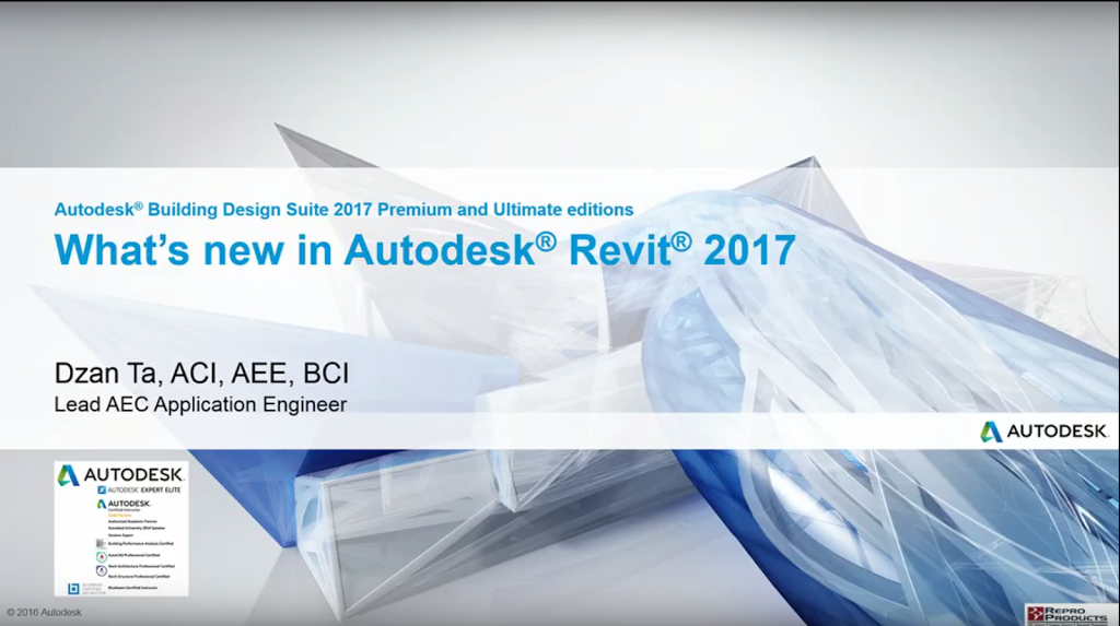
Our Lead Applications Engineer, and Autodesk Expert Elite trainer, Dzan Ta showcases some of the new features of Autodesk Revit 2017
Want a copy of this presentation for you to access on your own time?


Category Archives: Software
In today’s #TutorialTuesday, our very own Autodesk Expert Elite trainer and Lead AEC Application Engineer, Dza Ta showcases some of the new features of AutoCAD 2017.
For more informative, how-to videos and tutorials from our Autodesk Elite training professionals, visit us on YouTube.
Category Archives: Software
In today’s #TutorialTuesday, our very own Autodesk Expert Elite trainer and Lead AEC Application Engineer, Dza Ta showcases some of the new features of Revit 2017, such as Reinforcement Connectors, Variable Rebar
For more informative, how-to videos and tutorials from our Autodesk Elite training professionals, visit us on YouTube.
Category Archives: Software
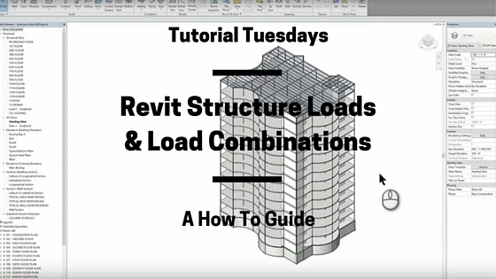
In today’s #TutorialTuesday, our very own Autodesk Expert Elite trainer and Lead AEC Application EnEngineer, Dza Ta gives us a “How To” tutorial of how to set up structure loads and load combinations in Autodesk Revit.
Learn More

Join Repro Products for our live webinar to learn how to use the new features in Revit 2017, including:
- Depth Cueing
- Autodesk Insight 360
- Autodesk Raytracer
- Formit 360 Converter
- Text Editor Improvements
- Hosted Railings
Need More?

Category Archives: Software

In today’s Tutorial Tuesday, our Application Engineer, Zoltan Ferenczy walks us through utilizing FARO Focus3D X 330 HDR laser scanning technology in an Architectural Renovation. See the video tutorial below and tell us what you think.
Learn More
Register for our free live webinar discussing the benefits of 3D Laser Scanning in the BIM workflow
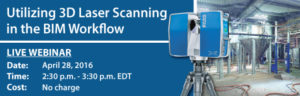
This webinar will cover:
Understanding of BIM and Integrated Project Delivery Processes
Overview of 3D Data Capture Process Using Laser Scanner
Using 3D Data in the Design Process

3D Laser Scanning Services
Repro Products’ 3D laser scanning services enable clients to add, modify, validate and document their design process in context from existing environments. Click here to learn more about our Laser Scanning Services.
Need More?
Category Archives: Software
In this installment of Tutorial Tuesday, Dzan Ta gives a detailed demonstration on how to use A360 Collaboration for Revit to empower your project team no matter where they’re located.
Autodesk® A360 Collaboration for Revit®
Autodesk® A360 Collaboration for Revit® is a subscription service that works with Revit® software to connect project teams with centralized access to BIM project data in the cloud . Stay connected in real-time using the Communicator chat tool within models enabling the entire project team to work on shared building information models.
Press play below to view the demonstration video:
Tutorial Tuesday | A360 Collaboration for Revit
A Detailed Demo
Presented by Dzan Ta
Lead AEC Application Engineer, Repro Products, Inc.
Learn More
Want to find out more about A360 Collaboration for Revit, including how other companies have integrated it into their workflows?
Register for Project Collaborate | Live Training Event

Want more Tuesday Tutorials?

Category Archives: Software
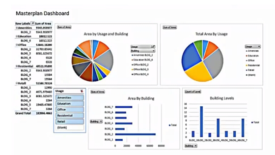
In today’s Tutorial Tuesday, our very own Dzan Ta provides us with a step-by-step tutorial of how to use Autodesk Revit, Dynamo, and Microsoft Excel to create a digital project dashboard.
In this tutorial, our Lead AEC Applications Engineer, Dzan goes over how to create and use digital dashboards, and empowers you with the expertise to create your own to utilize within your workflows.
Original content was created by CAD Blog website and ArchSmarter. I created this video as a learning exercise for myself and to share their knowledge. Credit to be given to original authors.
Need Training?
Are you in need of training for yourself and/or employees? Repro Products is an Autodesk Authorized Training Center (ATC). Check out our training calendar for a comprehensive schedule of our training classes that we offer both on-location and online.
Need Software?
Get the benefits of increased productivity, predictable budgeting, and simplified license management with Autodesk® Subscription. You get new upgrades and any incremental product enhancements of your Autodesk software, plus you get exclusive license terms available only to subscription members.

Contact us today and discover why Repro Products is the best choice to improve the success of your business.
Need more information?

Category Archives: Software
 |
| Original Image Courtesy of Autodesk |
What’s New in Autodesk® Infraworks® 360
On February 8th, Autodesk announced significant changes to its preliminary civil engineering design software – Autodesk® Infraworks® 360.
Autodesk decided to repackage its Infraworks® 360 core product, integrating all of the vertical modules and while maintaining price. Until now, in order to access the road, drainage, and bridge design modules of the software they had to be purchased separately. Not only does this repackaging offer you access to all of the modules in the core product, but you get all of this value with no increase in price.
These changes were brought about as Autodesk seeks to simplify the offering and enable customers to accelerate their move to BIM and continue to improve their project workflows.
Why Infraworks® 360?
Infraworks ® 360 is Autodesk’s BIM-based infrastructure design tool specifically created for civil engineers. Infraworks ® 360 is designed to aggregate real-world data, including 2D CAD, 3D model, GIS and raster data and LiDar and Photogrammetry capture. By bringing all this data together, the software creates a 3D model for users to design within the context of reality.
Infraworks ® 360 has been a product favorite of Repro Products. However, as sometimes happens when new technology is brought to the market, the offering still did not quite fit with our client’s needs vs. price. Now with the repackaged core product, customers can access all of the advanced features included in the vertical applications models.Save time and money using the data you have access to instead of purchasing or creating what you need.
If you are interested in pricing or learning more about the updated offering of Infraworks® 360, contact Repro Products.

Learn More
Register for our free webinar to learn how to Speed the Civil Infrastructure Design process utilizing the data you already have access to.
Stay updated on the Civil engineering updates from Autodesk by subscribing to the Repro Products blog. And follow us on Twitter, Facebook & LinkedIn for real-time updates and industry news.
Category Archives: Software

Presented by Dzan Ta, Repro Products, Inc.
Dzan Ta is an Autodesk Certified Instructor and holds many certifications in multiple Autodesk products for the AEC industry.
For more videos, content and more from Repro Products, Inc.
Subscribe to our YouTube Page Follow us on Twitter Like us on Facebook Like Us on LinkedIn
Category Archives: Software
Dzan Ta is an Autodesk Certified Instructor and holds many certifications in multiple Autodesk products for the AEC industry.
For more videos, content and more from Repro Products,Inc.
- Subscribe to our YouTube Page
- Follow us on Twitter
- Like us on Facebook
- Like Us on LinkedIn
Category Archives: Software
Dzan Ta is an Autodesk Certified Instructor and holds many certifications in multiple Autodesk products for the AEC industry.
For more videos, content and more from Repro Products, Inc.
- Subscribe to our YouTube Page
- Follow us on Twitter
- Like us on Facebook
- Like Us on LinkedIn
Category Archives: Software
.
Dzan Ta is an Autodesk Certified Instructor and holds many certifications in multiple Autodesk products for the AEC industry.
For more videos, content and more from Repro Products, Inc.
- Subscribe to our YouTube Page
- Follow us on Twitter
- Like us on Facebook
- Like Us on LinkedIn
Category Archives: Software
For more videos, content and more from Repro Products, Inc.
- Subscribe to our YouTube Page
- Follow us on Twitter
- Like us on Facebook
- Like Us on LinkedIn
Category Archives: Software
For more videos, content and more from Repro Products, Inc.
- Subscribe to our YouTube Page
- Follow us on Twitter
- Like us on Facebook
- Like Us on LinkedIn
Category Archives: Software
Dzan Ta is an Autodesk Certified Instructor and holds many certifications in multiple Autodesk products for the AEC industry.
For more videos, content and more from Repro Products, Inc.
- Subscribe to our YouTube Page
- Follow us on Twitter
- Like us on Facebook
- Like Us on LinkedIn
Category Archives: Software
Are you still using a manual vehicle turn template to evaluate the movements of steered vehicles? Many of our clients are.
As an Autodesk reseller for over 20 years, when a product comes along that specifically addresses our client’s needs, we want them to know about it.
A newer Autodesk product that does not get a lot of attention is Vehicle Tracking. It makes it much easier to do swept path analysis, parking lot layout and roundabouts within AutoCAD software.
Our clients’ projects’ needs change throughout the design process. Vehicle Tracking is created with an intelligent workflow. You should not need to delete, start-over, or explode a vehicle path. The simulations are stored within the .dwg file so you or anyone with Vehicle Tracking can re-visit the vehicle path, edit the geometry, and even check and change vehicle speed.
How accurate and easy is it for you to predict how a vehicle will navigate a parking lot? Can large trucks maneuver through tight spaces and not drive over curbs?
Do you design with wasted space in order to ensure vehicle maneuverability?
One our clients’ favorite tools in Vehicle Tracking is the Grip Editing mode. Grips enables you to tailor the maneuver to a driver’s behavior. How do you currently design for the driver of a large truck who needs to swing out wide to the left before making a tight right hand turn?
No one likes to have to do their work in in multiple software applications. Vehicle Tracking has a tight integration with Civil 3D and AutoCAD. With Civil 3D, it includes 3D surface tracking and native object creation. Within Civil 3D, you can drive vehicles over surfaces and carry out ground clearance analysis checks in 3D.
Since you are working inside of AutoCAD or Civil 3D, you can connect the modeling and design processes. This enables the reuse of preliminary design work in the detail design phase. Also, because you are using Civil 3D or AutoCAD, you can easily consider safety factors interactively during the design process. You can also use the integrated analysis and simulation tools to predictably evaluate movement.
Vehicle Tracking is an all-in-one product. There are not a myriad of different modules that you need to buy to get the important features you need. The all-in-one product concept allows users to not have to redo or import their work into different packages. A great example is being able to record AVI movie files from within the product while you are selecting a path. It eliminates the need to copy path alignments or points.
If you want to learn more about Vehicle Tracking, call Repro Products at (678) 385-2185. Also visit the events page of our website to see a listing of upcoming seminars and webinars on topics such as Vehicle Tracking: www.reproproducts.com/events.asp.
Category Archives: Software
Most of our clients’ questions about Autodesk software are around licensing. Should they have standalone or would they be better off to purchase a network license? As an Autodesk reseller for over 20 years, Repro Products has guided many companies through the changes and growth of Autodesk licensing. Recently the alternatives for acquiring Autodesk software have increased. Clients now have options of not only Stand-alone or Network but Perpetual and Usage/Time models as well.
One of the first questions we get from a client is how do I know if Network licensing is right for our business?
- Do you have 5 or more licenses? If yes, you should use Network Licenses.
- Do you have less than 5 people needing to use the software but they are partial time users? If yes, you should use Network Licenses.
- Do you have a one person design team but need to access it at the office or in the field or from home? No, a Stand-alone License with subscription covers that need.
Is Network Licensing Cheaper than Stand Alone? No and Yes
- At the time of software purchase, Network Licenses are an additional cost. Examples of real cost savings are below:
o Most clients who use design software rarely have all their software users using it 8 hours a day. The majority of company’s design teams have project meetings, client meetings and field work, in addition to design/modeling time. Since network licenses are based on a concurrent pool of licenses, typically a license per every user is not required. So money can be saved by not having to purchase a separate, individual license for every user.
o A tremendous amount of time is saved managing the licenses. With a network license, you can set up as many workstations as you need or want. Hardware replacement is a constant part of today’s new office lifestyle and keeping track of all the serial numbers, past serial numbers and versions can quickly become a large time-consuming process.
Do you have to be connected to the server to access a network license?
- No, a user can check out/check in (borrow) a license
Are there different ways to set up a license server?
- Yes, you can choose a single license server model or a distributed server model
Can network licensing help me gain more control? - Yes, it can help you control license access several ways, including who and by what time. You can create a report log, regulate how long a license can be used, reserve licenses for specific users or systems and control license recovery for idle products.
Category Archives: Software

Now that Repro Products is an Autodesk National Reseller and sells Xerox equipment, many of our customers do not know our background. With a name like Repro Products Inc. (RPI), newer clients wonder how does that relate to what they do? In 1979, Repro Products started as a reprographer. In this, our first blog, join us for a brief walk down memory lane to see what has changed since 1979:
- The Bee Gees were topping the charts and Disco was King
- The Walkman represented the newest “gotta have it” technology
- A gallon of gas cost less than a dollar
In 1979, while nothing was coming between Brooke Shields and her Calvins, we were selling drafting supplies and were a blue printer. It has been a long time since prints came out blue. And a lot has evolved at Repro Products – it’s a good thing, or we would be a footnote to history like the 8-track tape.
Recognizing the need to change with our customers and technology, through the years we added products and services to align with advancements that affected our design and construction clients:
- Our experience as a blue printer provided us with a unique perspective on engineering, architectural and construction industries and facilitated our move from selling drafting angles and tables into selling and supporting Autodesk Software. We have now been an Autodesk reseller for over 20 years and are a Gold Partner and Autodesk Authorized Training Center.
- Although we still do a lot printing for our clients, our print shop’s production services grew to incorporate digital services including managing plan rooms, metadata entry and data mapping.
- Clients wanted to be able to print in their offices and on jobsites. We became one of the South’s largest resellers of wide format equipment and service.
In the last decade there was another shift — a larger demand for half-size prints. Although printed on 11×17” paper, a half-size print requires more expertise from a printer than producing a regular office document. Five years ago, we expanded our decades-long affiliation with Xerox and became a Platinum Xerox Agent providing multi- function and production devices that support not only our architectural and construction customers’ drawings but also the office staff and marketing teams (and production printers) from a wide variety of businesses throughout metro Atlanta.
One part of our business works diligently with our clients helping them make better BIM (Building Information Modeling) models. The other part still prints 2D plans. As the two worlds become closer and closer in technology, we changed from just being in architects’ and engineers’ offices to also being out with our construction clients on their job sites. The experience of being in the field with our clients, working with them on projects they are trying to win and seeing the end results of jobs they pushed to make come together, we realized there were still some important solutions we needed to provide.
One large hole to fill was accurate building documentation. Our clients need it to bid a project, plan it effectively, ensure it is being built correctly and to provide a more complete deliverable to their clients. Everyone knows that as-built drawings are a myth. And even with BIM-enabled construction sites, the need to ensure what is being built as it is being built is important.
We knew that 3D laser scanning was the answer to getting this vital documentation. When choosing a 3D laser scanner manufacturer to align with, we needed the technology to be accurate, easy to use and travel ready. We partnered with FARO because their scanners fit the needs for both our own services and our clients. We offer the FARO line of 3D laser scanners as well as scanning services for those clients who do not want to do the scanning themselves. We also rent scanners for those in between.
Just possessing accurate data is not enough, though. We knew we had to own the proper data capture and use workflow. Receiving data that is approachable and usable is vital to our clients’ success. For our Autodesk software users, we train on how to actually use the data in the software. Our non-design clients receive an accurate 3D image file that lets them move around, see and measure virtually but with real, accurate data.
So that is 36+ years of evolution in under 800 words! Moving forward, our blogs will be specific to our lines of business so you can get timely information on just the subjects that interest you most: Autodesk software, 3D laser scanning, wide format printing and equipment and Xerox office and production equipment. Check back here weekly to see what’s new.